Key takeaways
What's inside
Hiking navigation guide advice boils down to one rule: never rely on a single tool. This roundup compares five field-tested navigation tools across accuracy, backup value, and ease of use, from a rugged GPS to a paper map and compass, so you can build a layered system that keeps you found even when your phone dies or the trail vanishes underfoot.
As an Amazon Associate we earn from qualifying purchases.
By Jake Thompson
How to Build a Hiking Navigation System
The safest navigation is layered, not dependent on one device. A phone can die, a GPS can fail, and clouds can hide the sun, so a smart hiking navigation guide pairs digital tools with analog backups. Start by thinking through three layers before you head out on any serious hike.
Primary Digital Navigation
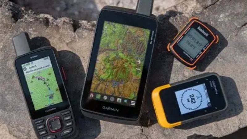
Most hikers navigate day to day with a phone app or a handheld GPS. A phone with offline topo maps is convenient and free-ish, while a dedicated GPS lasts far longer and survives abuse. Both show your live position on a map, which is the fastest way to confirm you are on route.
Battery is the weak point. Screens, cold, and constant checking drain power quickly, so carry a power bank or spare batteries. Any hiking navigation guide worth following treats digital tools as your primary layer but never your only one, because electronics fail at the worst possible moments.
Analog Backup Tools
A map and compass never run out of battery. A waterproof topographic map shows the whole area at a glance, and a baseplate compass lets you take bearings and orient the map to the land. Together they are the fail-safe that works when every electronic device in your pack is dead.
The catch is skill. Map and compass demand practice, since they do not show your position automatically. Learn the basics before you need them, and a solid hiking navigation guide will always list these analog tools as the backbone of any dependable backcountry system.
Emergency Communication
Navigation and rescue overlap when things go wrong. A satellite messenger adds two-way texting and an SOS button that works far beyond cell service, letting you share your location and call for help from anywhere. It is not a navigation tool first, but it is a critical safety layer.
Match communication to your risk. Day-hikers near towns may skip it, while remote solo travelers should not. A messenger turns a lost or injured situation from a crisis into an inconvenience, which is why many hikers now carry one alongside their maps and GPS.
Top Picks: The Best Hiking Navigation Tools
With those layers in mind, this hiking navigation guide lines up five field-tested tools that together build a dependable system. The table sums up each tool’s role, and the reviews below explain who each one suits and the trade-offs to weigh before you buy.
| Tool | Type | Key Feature | Best For |
|---|---|---|---|
| Garmin GPSMAP 67i | Handheld GPS | Maps plus inReach SOS | Primary navigation |
| Gaia GPS | Phone app | Offline topo maps | Everyday route-finding |
| Suunto MC-2 | Compass | Mirror and declination | Analog backup |
| Nat Geo Trails Illustrated | Paper map | Waterproof topo | Fail-safe backup |
| Garmin inReach Mini 2 | Satellite messenger | Two-way SOS | Emergency comms |
Garmin GPSMAP 67i – Best Primary GPS
The Garmin GPSMAP 67i anchors a serious navigation system. It combines multi-band accuracy and full offline topo maps with built-in satellite messaging and SOS, a bright three-inch screen, and very long battery life, so it handles both route-finding and emergencies in one rugged handheld device.
It is expensive and its satellite features need a subscription. But for hikers who want a dependable primary navigator that will not die when a phone would, it is the strongest all-in-one tool in this hiking navigation guide.
Gaia GPS – Best Phone App
Gaia GPS turns the phone you already carry into a capable navigator. It downloads detailed topographic maps for offline use, shows your live position, and lets you plan and record routes, giving day hikers a powerful, familiar tool without buying a separate device.
It leans on your phone’s battery and fragile screen, so it is not a standalone backcountry solution. But as an everyday route-finder that most hikers will actually use, paired with a backup, it is hard to beat for convenience and detail.
Suunto MC-2 – Best Compass
The Suunto MC-2 is a serious analog navigator that never needs power. Its sighting mirror enables precise bearings, adjustable declination corrects for magnetic offset automatically, and a clinometer and global needle make it suitable for careful off-trail navigation anywhere in the world.
It costs more than a simple baseplate compass and offers more features than casual hikers need. But for the reliable, battery-free backbone of a navigation kit, its precision and durability make it a lifelong tool worth learning.
Nat Geo Trails Illustrated – Best Paper Map
A National Geographic Trails Illustrated map is the ultimate fail-safe. Printed on durable, waterproof, tear-resistant material, it shows an entire area’s trails, terrain, and features at a glance, and it works in any weather with no battery, no signal, and no risk of a cracked screen.
A paper map does not show your live position and requires basic map-reading skill. But paired with a compass, it is the one navigation tool that simply cannot fail, which is why experienced hikers never leave it behind.
Garmin inReach Mini 2 – Best Emergency Comms
The Garmin inReach Mini 2 adds a satellite lifeline to your kit. It sends two-way messages and an SOS from anywhere on Earth in a tiny, lightweight package, letting you share your position and call for rescue far beyond cell service on remote or solo trips.
It is a communicator first, so its navigation features are limited, and it needs a subscription. But for the peace of mind of being able to call for help anywhere, nothing here packs so much safety into so little weight.
Frequently Asked Questions
A few questions come up again and again when hikers read a hiking navigation guide. Here are quick, practical answers to help you build your system.
Can I just use my phone to navigate?
A phone with offline maps works for many day hikes, but batteries die, screens crack, and cold weather cuts power fast. For casual trips near help it may be enough, but for anything remote or multi-day, always carry a backup like a map and compass so a dead phone never leaves you lost.
Do I still need a map and compass with GPS?
Yes. Electronics fail, and a map and compass never run out of battery or signal. They are the reliable backbone of any navigation system and the tool that works when everything else has died. Learn to use them before you need them, then carry them on every serious hike.
What is the most important navigation skill?
Orienting a map to the terrain and knowing your rough location is the foundation. If you can match the map to what you see and take a basic compass bearing, you can navigate even without a live position. Practice these fundamentals close to home before relying on them in the backcountry.
Is a satellite messenger worth it?
For remote, solo, or multi-day trips, a satellite messenger is well worth the cost and subscription, since it can summon rescue where phones cannot. For short hikes near cell service, it is optional. Weigh how far you travel from help against the peace of mind two-way SOS provides.
See More:
- Best camp chair
- Lightweight camp chair
- Camping table review
- Backpacking cookware set
- Camp stove review
Final Thoughts
A good hiking navigation guide is really about layers, not a single gadget. The GPSMAP 67i and Gaia GPS handle primary navigation, the Suunto MC-2 and a Trails Illustrated map form your fail-safe backup, and the inReach Mini 2 adds an emergency lifeline. Build these layers, learn the skills, and you will always find your way home.